Mountain bike trail difficulty rating system
In order to provide fun and challenge for bike park or trail system visitors, trails of different difficulty levels are developed. To inform visitors about the required skill level for each trail and encourage them to use trails that match their skills, an appropriate trail difficulty rating system should be implemented.
Apart from skills parks and trail filters or qualifiers, an effective trail rating system will significantly contribute to:
- Managing risks and reducing the injuries
- Providing crucial information regarding trails to visitors
- Providing a better user experience
- Encouraging step-by-step progression
The base for trail difficulty rating is International Trail Marking System, like in skiing, however, there are no trail rating systems in mountain biking that would be spread worldwide, as these systems often vary from country to country. A variety of trail rating systems have contributed to confusion among bike park visitors who often do not recognize symbols that mark trail difficulty or are surprised by different trail rating systems. Apart from that, some resorts use their own symbols to mark different levels, which brings even more confusion to the visitors from more distant locations and abroad.
It would be beneficial for everyone and especially trail users to develop a uniform system for trail rating at least in the wider European area.
Regardless of the confusion caused by different trail rating systems, in our opinion, the most advanced trail rating system has been developed by the International Mountain Bike Association (IMBA), which provides an accurate classification of trails according to the:
- Treadth width
- Treadth surface
- Maximum and average trail grade
- Natural obstacles and technical trail features.
According to these parameters, trails are separated into five levels of difficulty:
- Easiest (white circle)
- Easy (green circle)
- More difficult (blue square)
- Very difficult ( black diamond)
- Extremely difficult (double black diamond)
As the system developed by IMBA is based on the symbols that are more common in North America, the system developed by the Forestry Commission of Great Britain provides a good example of the adaptation of the IMBA system to European systems and symbols known from skiing.
As no trail rating is completely objective, the rating should not be rigorously based on trail systems but should be rated relative to other trails in the region and based on personal experiences, common sense, and input of trail visitors, who will provide valuable feedback on the accuracy of your rating. For example, the trail often seems to be more difficult for some users because of psychological challenges based on the terrain along the trail. Trail rating should consider only the technical difficulty of the trails, however physical exertion of the trails can be shown through trail length and elevation. Individual judgment is also required as trails do not always fit into one category by all parameters and it has to be decided which parameters will prevail.
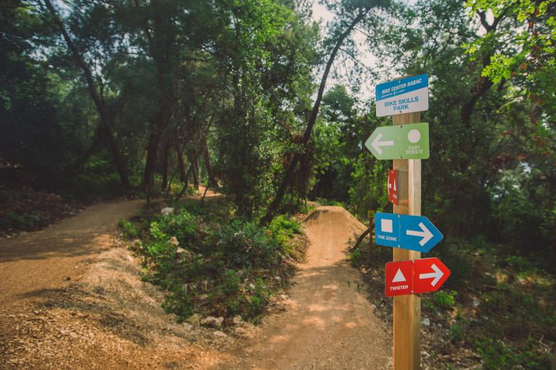
Trail ratings are useless unless the difficulty of each trail is properly and adequately marked along the trail and also displayed on the maps of trail systems so that the users can plan ahead and are encouraged to choose the trails that match their skills. Apart from the signage of the trail rating, the features on trails such as drop, jumps, etc., and optional lines should also be marked to inform the users about the upcoming obstacles.
Efficient trail rating will provide information that will encourage the users to use the trails that match their skills. This will make all users more satisfied as they will be directed to the trails where they will feel comfortable and will not cause distractions to more advanced and faster users. And as you know satisfied users will return more often and would spend more money!


